Thinking about buying ranch or farm land near Wichita Falls? You are not alone. North Texas offers open skies, productive soils, and strong agricultural roots. The key is knowing how to evaluate water, access, taxes, and mineral rights before you write an offer. In this guide, you will get a clear, step-by-step process and local links to help you move with confidence. Let’s dive in.
Start with your plan
Before you scroll listings or drive county roads, write down what you want the land to do.
- Primary use: cow-calf, hay, row crops, recreational, homesite, or mixed use.
- Size and budget: include improvements, fencing, water systems, and recurring costs.
- Access: public road frontage or deeded easement, and the vehicle/equipment you will run.
- Must-haves: wells, pens, cross-fencing, power to barns, and room for a homesite if needed.
A simple plan will guide every other decision.
Understand local land rules
City vs. county authority
In Texas, cities control zoning inside city limits and often in their extraterritorial jurisdiction (ETJ). Counties do not have broad zoning but do regulate subdivisions, roads, and certain infrastructure. This city-versus-county split matters when you plan a homesite, divide acreage, or extend utilities. For background on how local authority works in Texas, see this overview of local power and land-use limits from the Texas Tribune.
If a tract lies inside Wichita Falls city limits or the ETJ, contact the city’s planning and permitting staff for setbacks, building, septic, and utility questions. Outside city limits, look at county plat requirements and exemptions under state law. Read recorded plats closely for easements and right-of-way notes.
Where to check records
- Ownership and use: Use the Wichita Appraisal District for Wichita County parcels and the Clay County Appraisal District for Clay County to confirm the owner name, legal description, and current use classification. Start with the Wichita Appraisal District and the Clay County Appraisal District.
- Deeds and plats: For Clay County, recorded instruments and plats are searchable through the Clay County Clerk. This is where you verify easements and restrictions.
Water is a make-or-break issue
Municipal reservoirs and regional projects
Wichita Falls relies on regional lakes, including Lake Arrowhead, Lake Kickapoo, and Lake Kemp, and has implemented advanced water projects in past droughts. You can explore Lake Arrowhead basics through the Texas Water Development Board’s reservoir summary. Proposed new reservoirs can affect long-term land availability. For example, the Texas Commission on Environmental Quality approved a permit for the proposed Lake Ringgold, a project that has drawn local attention. Learn why projects like this matter through recent coverage of Lake Ringgold’s TCEQ permitting and the City’s water resources information.
If you are considering land in areas that could be inundated by a future reservoir, watch permitting updates and consult a surveyor and title company about any filed maps or acquisition notices.
Groundwater and GCD checks
Many rural properties in Clay County and around Wichita Falls rely on wells. In Texas, groundwater is often managed by local Groundwater Conservation Districts (GCDs). Your first step is to see whether the tract is inside a GCD and what rules apply. Use the Texas Water Development Board’s GCD information page and map resources and the Texas Alliance of Groundwater Districts GCD Index viewer. If a GCD covers the property, read its rules on well spacing, production, and possible metering or reporting.
Well due diligence
If a well exists, ask for the driller’s report and well log. Arrange a pump test and lab analysis that checks yield, static water level, and common quality parameters like bacteria, nitrate, and salinity. If you plan irrigation or large stock water, confirm whether permits or production limits apply under any GCD rules.
Soils, floodplain, and building suitability
North Texas often has expansive clays that can affect foundations, roads, and pond embankments. Begin with the USDA NRCS Web Soil Survey. It provides soil maps, septic limitations, hydrologic group, and suitability for crops, pasture, and pond excavation. Run every candidate tract through the NRCS Web Soil Survey. If you plan a homesite or large structure, have a geotechnical engineer evaluate bearing capacity and expansive clay risks.
Also check floodplain maps before you invest in site work. If the parcel includes mapped floodplain, plan building pads and fencing accordingly and price in flood insurance or avoidance.
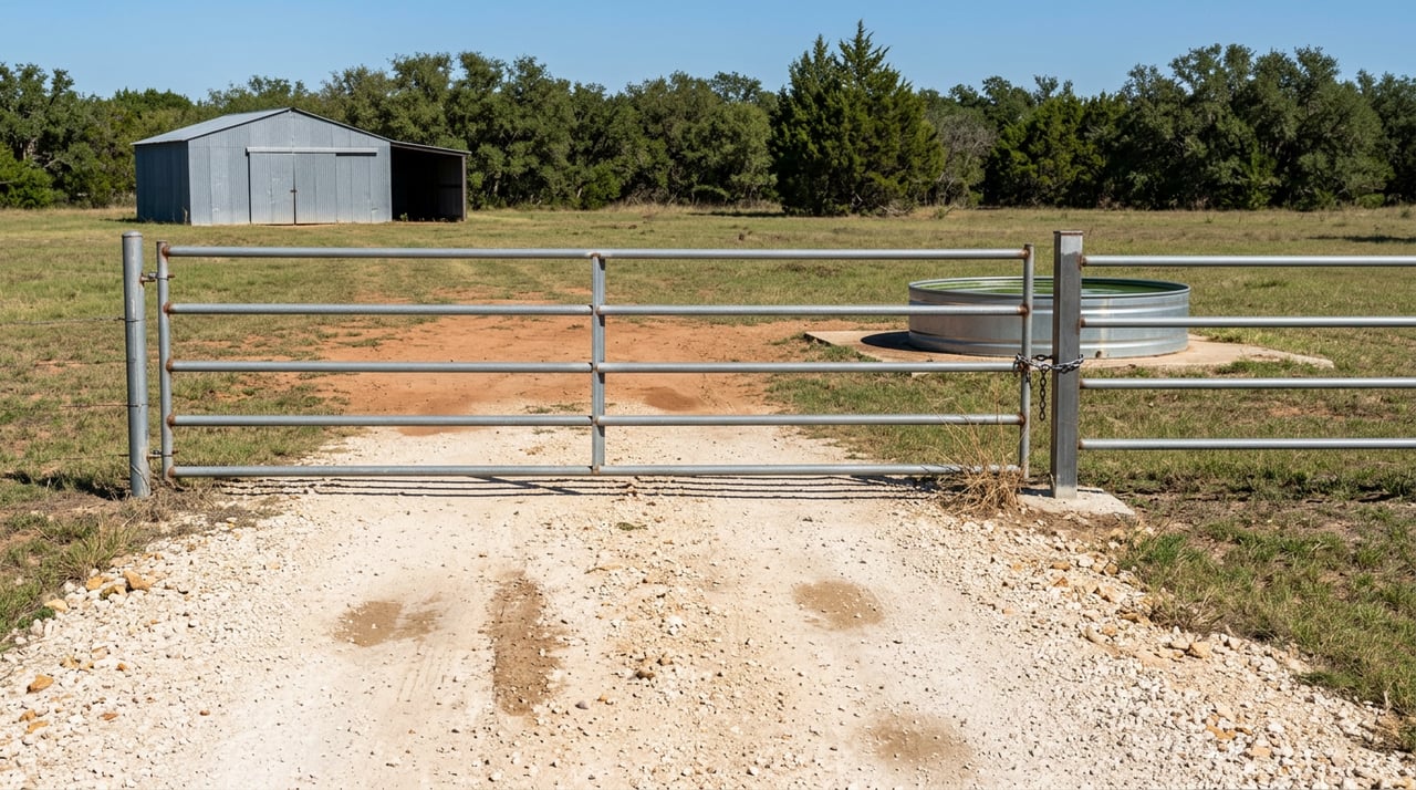
Access and on-site infrastructure
When you visit a property, confirm how you get in and out in all seasons. Distinguish between public frontage, a deeded easement, or a private road. Ask who maintains a shared road or gate. Then inventory improvements and their condition:
- Fences and cross-fencing, gates, and working pens.
- Barns, shops, equipment sheds, and power service to improvements.
- Stock tanks and ponds, pumps, troughs, and any irrigation setup.
- Pasture health, brush density, encroaching mesquite, and evidence of overgrazing.
A practical list of fixes and upgrades will help you budget after closing.
Title, survey, and mineral rights
Order a title commitment and require a current boundary survey. Read exceptions and recorded easements closely. In Texas, the mineral estate is often severed from the surface and is dominant. That means mineral owners may have surface-use rights for development. Ask the title company for mineral and lease history, and include purchase language to manage surface use if that is important to your operation. If surface control is critical, negotiate for mineral interests or an express surface-use agreement.
Property taxes and agricultural valuation
Open-space (often called ag) valuation can lower your property tax bill if your use meets local standards. Eligibility hinges on the county’s productivity criteria and documented use over a qualifying period. Confirm current classification and any active ag or wildlife management valuation with the county appraisal district. Start with the Wichita Appraisal District and the Clay County Appraisal District. Ask the seller for grazing leases, cropping records, and dates of qualifying use. If you change use after closing, understand rollback tax risk and filing deadlines.
Financing options and conservation programs
Bare land and ranch loans differ from typical home mortgages. Common paths include:
- Farm Credit and other ag lenders with long amortizations and land-specific underwriting.
- USDA Farm Service Agency programs for eligible beginning farmers and ranchers.
- Conventional bank portfolio loans tailored to acreage.
- Seller financing when available, which can offer flexible terms.
Terms and rates change, so speak with lenders early for pre-qualification. You can also explore NRCS and FSA programs like EQIP for cost-share on conservation practices and CRP for marginal cropland. These can affect income, management, and future easements, so review them with your local USDA Service Center.
A practical due-diligence checklist
Use this list to structure your offer timeline and contingencies:
- Confirm owner name and legal description. Pull recorded deeds and any plats from the Clay County Clerk.
- Order a title commitment and require a current boundary survey.
- Verify easements, rights-of-way, and deed restrictions in the title documents.
- Run a soils report in the NRCS Web Soil Survey. If building, schedule a geotechnical evaluation.
- Check mapped floodplain and plan improvements accordingly.
- Confirm any existing well logs; schedule a pump test and lab water analysis.
- Determine if the tract lies in a GCD using the TWDB GCD info page or TAGD GCD Index. Read the district’s rules.
- Confirm appraisal classification and ag or wildlife valuation status with the Wichita Appraisal District or the Clay County Appraisal District.
- If inside or near Wichita Falls city limits or ETJ, review city permitting and water information through the City’s utility and water resources page.
- In your contract, include contingencies for title and mineral review, survey, well testing and water quality, soil and septic approval, access acceptance, and financing appraisal.
How we help buyers in Wichita Falls and Clay County
You deserve clear answers and a smooth process. Our team brings boots-on-the-ground knowledge of fencing, water, soils, and access, plus the transaction structure to match your goals. Whether you want a quiet negotiated purchase or a time-defined auction for price discovery, we help you compare options, line up inspections, and close with confidence. Ready to walk a tract or register for an upcoming auction? Reach out to Williams Realty & Auction Service.
FAQs
What should I check first when buying ranch land near Wichita Falls?
- Confirm legal access, water source, and current appraisal district classification, then run soils in the NRCS Web Soil Survey and plan a title and mineral review.
How do I know if a Clay County tract is in a Groundwater Conservation District?
- Search the TWDB’s GCD resources or the TAGD Index map; if covered, call the district to confirm well spacing, permitting, and production rules.
What is Lake Ringgold and why does it matter to buyers?
- It is a proposed reservoir near Wichita Falls; permitting progress matters because future acquisitions or inundation zones could affect certain tracts.
Where can I find soils and septic suitability for a parcel?
- Use the USDA NRCS Web Soil Survey for soil maps and limitations, then hire a geotechnical or septic professional for on-site confirmation.
How do mineral rights affect a ranch purchase in Texas?
- The mineral estate can be severed and is dominant; review mineral title, any leases, and consider surface-use language to protect your operation.
Who handles agricultural valuation in Wichita and Clay Counties?
- The county appraisal districts administer open-space and wildlife valuations; contact Wichita CAD or Clay CAD for eligibility, filing deadlines, and rollback rules.